The Science
The Sardine Run Route: Where It Starts, Where It Finishes
Updated 23 July 2026 · 9 min read · By the Sardine Run Africa crew
The short answer: the sardine run starts on the Agulhas Bank, the broad, cool shelf off South Africa's southern tip where the sardines spawn, and it finishes on the southern coast of KwaZulu-Natal, historically reaching Durban around 25 June. Between those two points lies roughly the entire Eastern Cape coastline, and the shoals swim it the hard way: north-east, against the flow of one of the strongest ocean currents on Earth.
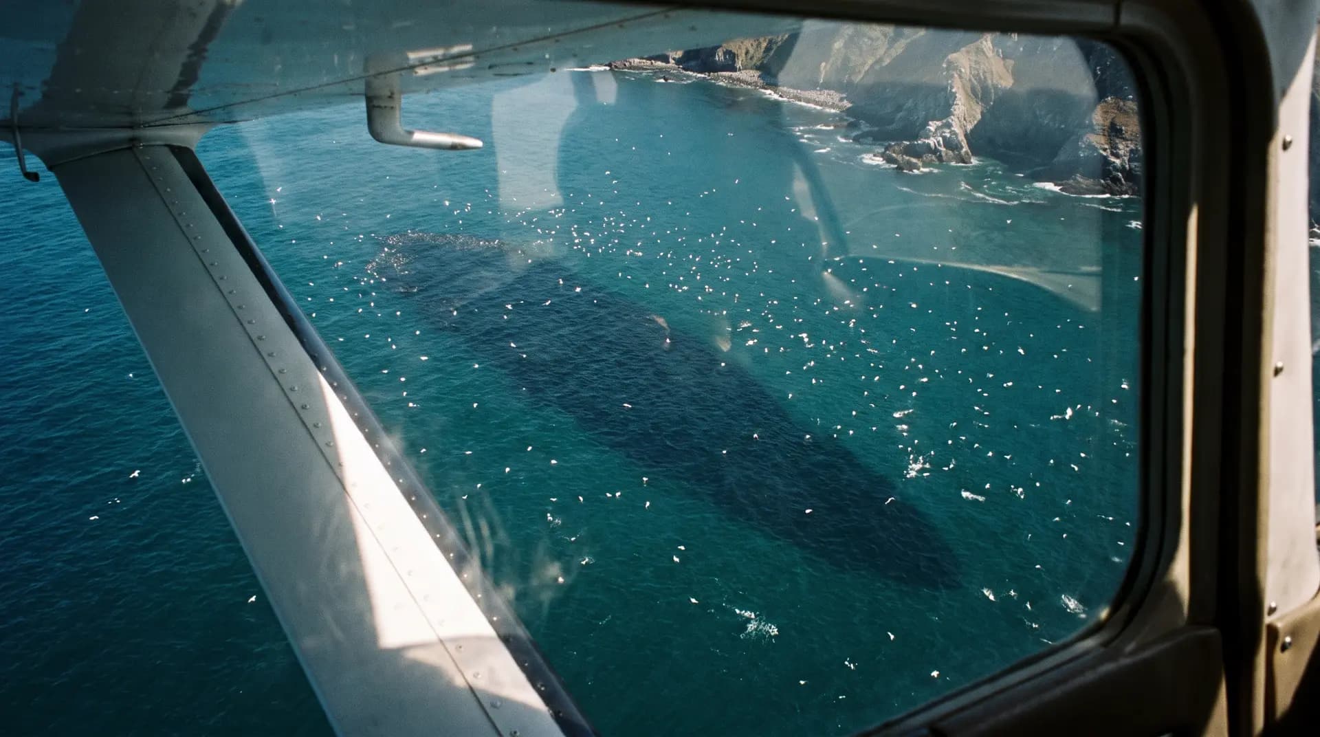
That detail is the key to the whole event. The Agulhas Current pours warm Indian Ocean water south-west along this coast all year. Sardines are cool-water fish that prefer 14 to 20 degrees Celsius, so they should have no business heading toward the subtropics. They only move when winter opens a narrow ribbon of cold water between the current and the beach. That ribbon is the route. It is rarely more than a few kilometres wide, which is why shoals reported at up to 7km long and 1.5km wide get squeezed within sight of the sand, and why the predators know exactly where to wait.
This guide follows the journey stage by stage, from the spawning grounds past Gqeberha, East London and Chintsa, across the Kei River mouth, through the Waterfall Bluff gateway near Mbotyi and into southern KZN. If you understand the route, the biggest decision of your trip (where to base yourself, and when) largely makes itself.
Where the run starts: the Agulhas Bank
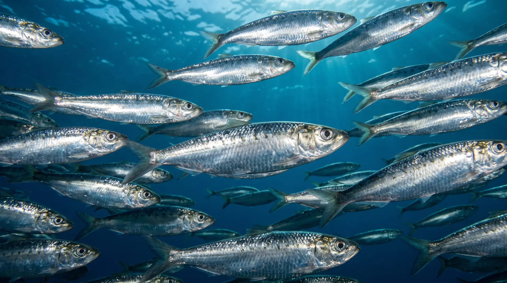
Every sardine in the run begins life on the Agulhas Bank, the wide continental shelf that fans out south of the country between Cape Agulhas and Gqeberha. The Southern African pilchard (Sardinops sagax, in plain terms a sardine up to about 25cm long) spawns there in the southern summer, with a single female releasing up to around 27,500 eggs per spawning. The Bank suits them: cool, productive, plankton-rich water over a shelf broad enough to hold enormous shoals.
So the run does not start with fish suddenly appearing off a beach. It starts months earlier as an unseen build-up of biomass on the Bank. As autumn tips into winter, part of that population gathers and begins pushing east and then north-east along the coast. Researchers read this as a seasonal reproductive movement of a cool-water-adapted fish, and the full explanation of why they do it is its own story. What matters for the route is simple: the starting gun fires off the southern Cape, far from where most people ever see a bait ball.
The cold-water corridor: why the shoals hug the coast
Look at a sea-temperature map of this coast in January and the run seems impossible. The Agulhas Current runs hot, fast and south-west, exactly opposite to where the sardines are headed. In winter, though, the picture changes inshore. Cold counter-currents and pockets of upwelling develop between the main current and the shore, dropping inshore temperatures below the roughly 21 degree ceiling the sardines can tolerate. A corridor of acceptable water opens up, pinned against the land.
The shoals move up inside it. Step outside the corridor and they hit water that is too warm; the Agulhas Current acts as a moving wall on their seaward flank. This is why the run hugs the coast so faithfully, sometimes pushing shoals into the surf zone itself, and it is why the event is so watchable. The fish are not choosing scenery. They are threading a thermal needle.
It also explains the run's biggest uncertainty. In warm winters the corridor forms weakly, late, or barely at all, and the run stalls or fizzles. Water temperature is the single variable every skipper on this coast watches, and it should shape when you book your season dates more than any brochure calendar.
The 21 degree rule
Sardines prefer 14 to 20 degrees Celsius and the run needs inshore water below about 21 degrees. No cold corridor, no run. This is why no honest operator guarantees bait balls, and why a flexible, multi-day expedition beats a single boat day.
The route, stage by stage
From the Bank, the route reads like a roll call of the Eastern Cape coast. Timings below are the historical pattern; individual years run early, late, strong or thin.
| Stage | Coastline | Typical timing | What happens |
|---|---|---|---|
| 1. Agulhas Bank | Cape Agulhas to Gqeberha shelf | Summer to autumn | Spawning and build-up of shoals on the cool southern shelf |
| 2. Gqeberha | Algoa Bay and eastward | May | First coastal pulses round the corner into the east coast system |
| 3. East London and Chintsa | Buffalo River to the Kei | May to June | The early phase: shoals in the corridor, dolphins and gannets working, few boats on the water |
| 4. Kei River to Coffee Bay | Southern and central Wild Coast | Early to mid June | The run crosses onto the Wild Coast proper; shoals historically passed the Bashee River around 8 to 9 June |
| 5. Waterfall Bluff and Mbotyi | Pondoland, near Port St Johns | Mid June to July | The shelf narrows sharply and funnels the run close inshore; the traditional mid-season hotspot |
| 6. Southern KZN | Port Edward toward Durban | Late June to July | Historically reached Durban around 25 June; increasingly unreliable since the early 2000s |
Gqeberha to the Kei: the southern leg
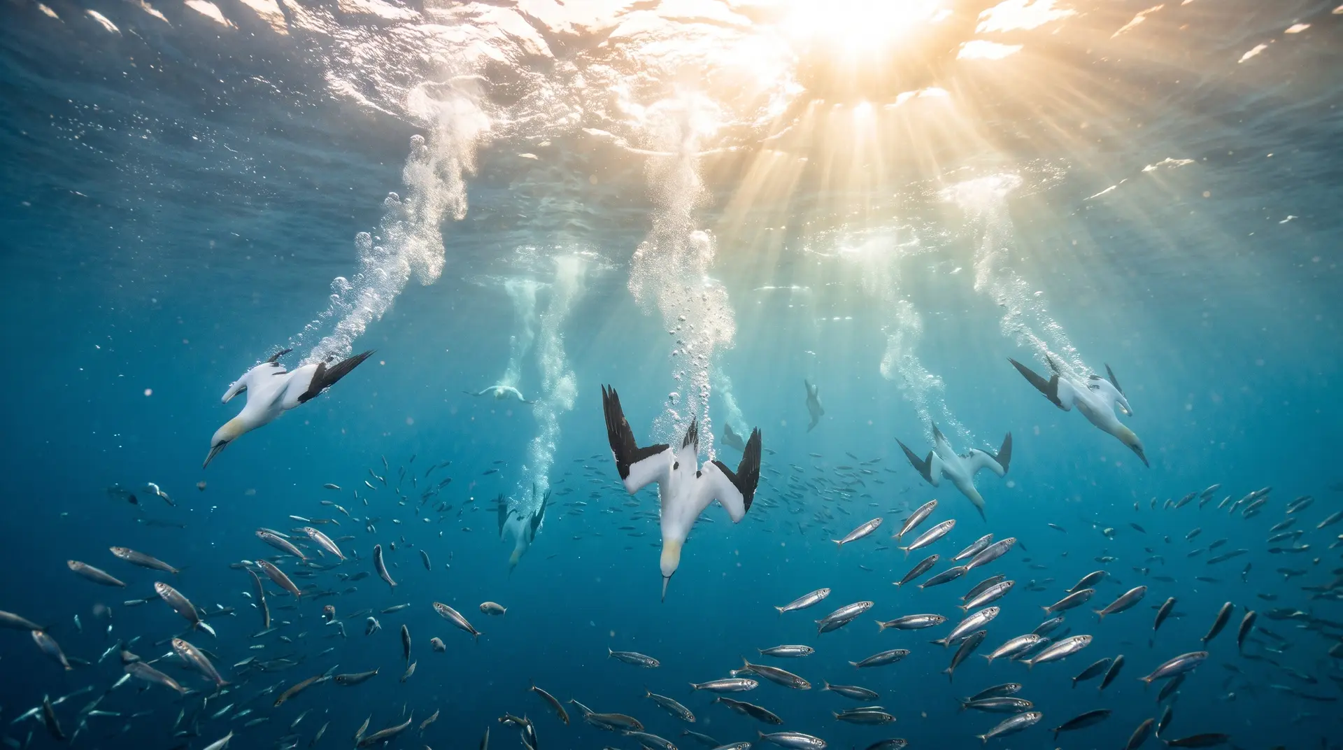
The stretch from Gqeberha past East London is where the run first becomes something you can plan a trip around. PADI's own guidance places the early phase of the run, in May and June, in the waters near Gqeberha and East London before the action shifts north. The shoals here are fresh into the corridor, the common dolphin pods (which can number in the thousands) are assembling, and Cape gannets begin their 30-metre dive-bombing raids that give away shoal positions from kilometres off.
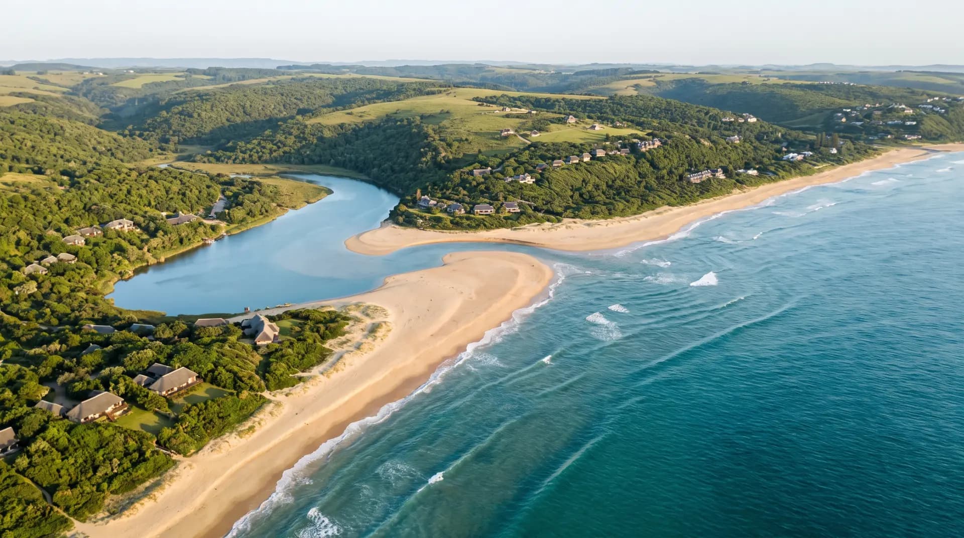
Chintsa sits squarely on this leg, about 40 minutes from King Phalo Airport outside East London, at the point where the run leaves the city coastline behind and commits to the Wild Coast. It is the reason our expeditions run from Chintsa rather than further north: you meet the run early, on a stretch of coast where only a handful of boats operate. The fleet follows the fish north through June. The fish come past here first.
Then comes the Kei River mouth, the historical boundary of the old Transkei and the psychological start of the Wild Coast. North of the Kei the coast empties out. Roads pull inland, settlements thin, and for the sardines the geometry of the seafloor starts to change in a way that defines the second half of the route.
Waterfall Bluff: the gateway where the shelf narrows
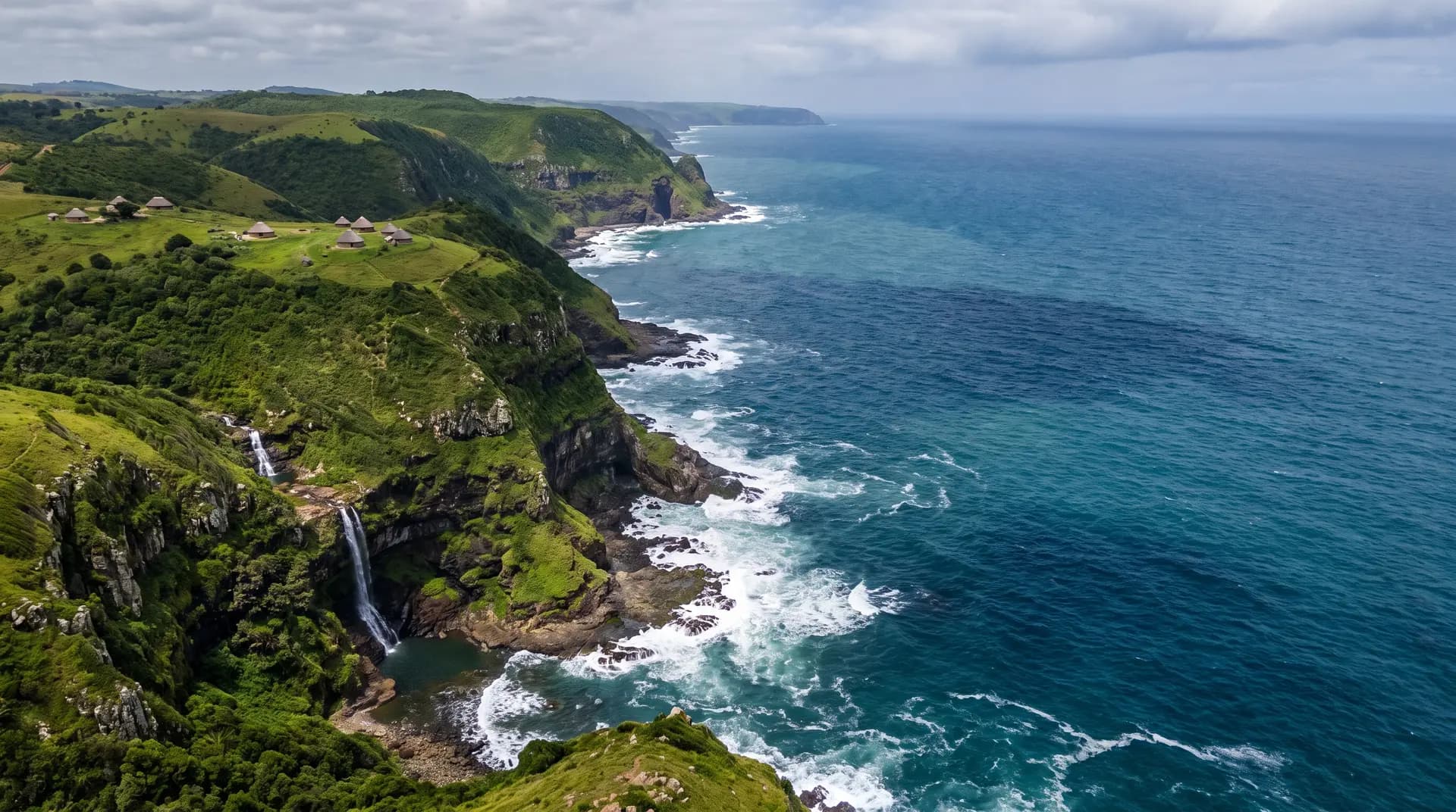
Off much of the Eastern Cape the continental shelf gives the shoals room to spread: they can sit deeper, wander a few kilometres offshore within the cold corridor, and pass by unnoticed. Near Waterfall Bluff, the cliff-lined stretch of Pondoland coast close to Mbotyi, that room disappears. The shelf narrows hard, the deep water of the Agulhas Current presses in toward the cliffs, and the cold corridor is pinched into its tightest squeeze on the whole route.
The result is a funnel. Everything moving up the coast, sardines and the predator column behind them, has to pass through a compressed band of water close inshore. Shoals that were dispersed become concentrated. Predators find and herd them faster, and bait balls (typically 10 to 20 metres across, usually gone within ten minutes) form at a rate the wider southern shelf rarely matches. This is the geographic reason Port St Johns and Mbotyi became the run's famous mid-season venues, a story we cover properly in the Port St Johns guide.
It cuts both ways. The funnel concentrates boats as well as fish, and by the time the run reaches Pondoland in late June it has already swum past hundreds of kilometres of quieter coastline to the south. Neither end of the route is "the" sardine run. They are different phases of the same animal event.
Where the run finishes: southern KZN and the Durban question
The traditional finish line is the southern KwaZulu-Natal coast. In the classic pattern, shoals crossed into KZN in late June and reached Durban around the 25th. None of this is new: the run's earliest written reference dates from 1853.
That ending has become the least dependable part of the route. The KZN leg has weakened noticeably since the early 2000s, and in warm years the run effectively finishes on the Wild Coast, never arriving off Durban in force. Warming inshore water is the documented pressure: the further north the shoals push, the harder it is for the cold corridor to hold.
The practical takeaway for a traveller is blunt. Do not plan a sardine run trip around the finish line. KZN search interest is high (people still hunt for "sardine run Durban" every winter), but the reliable action lives further south, on the Eastern Cape leg of the route. Our guide to choosing a viewing base works through that decision town by town.
Reading the route as a traveller
Once you see the run as a moving line rather than a place, trip planning gets simpler. Base yourself early on the route (East London and Chintsa) and you target the May to June phase: fewer operators, an easy flight into King Phalo Airport, and the run arriving rather than departing. Base yourself at the funnel (Port St Johns or Mbotyi) and you target the compressed mid-season phase, sharing it with the bulk of the fleet. Base yourself in KZN and you are betting on the route's least reliable stage.
Whichever leg you choose, the fundamentals stay constant along the whole line: the same dolphins doing the herding, the same Bryde's whales crashing the bait balls, the same gannets falling out of the sky. The route decides when and how concentrated it is, not whether the cast shows up.
Our 2027 expeditions run seven days from Chintsa on the southern leg, timed for the corridor's early phase. Dates and pricing are on the packages page, and the season sells on a first-booked basis.
Frequently asked questions
Where exactly does the sardine run start?
It starts on the Agulhas Bank, the broad continental shelf off South Africa's southern tip, where the sardines spawn in the southern summer. The visible coastal run begins when shoals from the Bank push east past Gqeberha in about May and enter the cold inshore corridor running up the Eastern Cape.
Where does the sardine run finish?
Historically on the southern KwaZulu-Natal coast, with shoals reaching Durban around 25 June in classic years. Since the early 2000s the KZN leg has weakened, and in warm winters the run effectively ends on the Wild Coast without arriving off Durban in strength.
Why do the sardines follow the coast instead of open ocean?
Because the only water they can tolerate is a narrow band of cold counter-current and upwelling trapped between the shore and the warm Agulhas Current. Sardines prefer 14 to 20 degrees Celsius, and the run needs inshore water below about 21 degrees, so the corridor pins the entire migration against the land.
What is Waterfall Bluff and why does it matter to the route?
It is a stretch of cliff-lined Pondoland coast near Mbotyi where the continental shelf narrows sharply. The narrowing squeezes the cold corridor into a tight inshore funnel, concentrating shoals and predators, which is why the Port St Johns and Mbotyi area became the run's famous mid-season hotspot.
Can you see the sardine run from Cape Town?
No. Cape Town sits west of the route; the run's coastal phase happens along the Eastern Cape and, in good years, southern KZN. The nearest practical bases are on the Eastern Cape coast, and East London's King Phalo Airport is the easiest gateway, with direct flights from Cape Town and Johannesburg.
Does the run pass every point on the route every year?
No. The route is a tendency, not a timetable. In strong, cold winters shoals track the full line from Gqeberha into KZN; in warm years the corridor forms patchily and sections of coast see little action. This is why multi-day expeditions with time to follow the water beat fixed single-day outings.
Keep reading
Meet the run on its southern leg
Our 7-day 2027 expeditions launch from Chintsa, on the early stretch of the route where the shoals arrive first and the water is far less crowded than the mid-season funnel. Seats are limited per boat, so tell us your preferred weeks and we will hold dates while you plan.
Boats carry small groups only, and prime weeks go 6-12 months out.